
Our original plan was to go to Reynisfjara and Vik in the morning, Vestmannaeyjar in the afternoon. We bought our ferry tickets in advance, per the recommendation that they were prone to selling out (3pm departure, 7:30pm return).
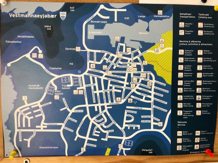
The ferry port is the only thing in the area, 10 minutes down an offshoot of Hringvegur (Ring Road, Route 1). There are a few vending machines inside the ticket office, otherwise that’s it.
Earlier in the day, we discussed extending our stay and were able to switch our tickets to the 10pm departure instead of the 7:30pm. They had no issue and did not charge anything extra.
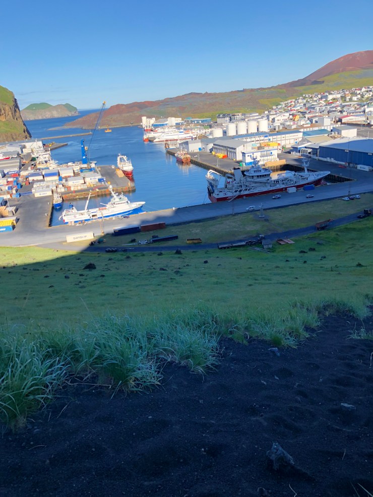
We had read plenty that the main island is completely walkable and everything is with a 20 minute distance. When we docked, we thought we would rent bicycles after hiking up Eldfell volcano crater.
The volcano hike was a challenge and we got lost almost immediately. Like many paths we’ve seen in Iceland, there are many branches and few markers to distinguish
At the base of the trail, there’s a split to either go up the volcano, or around it. We went up 😉
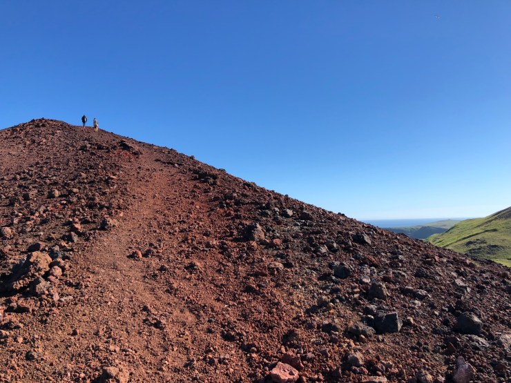
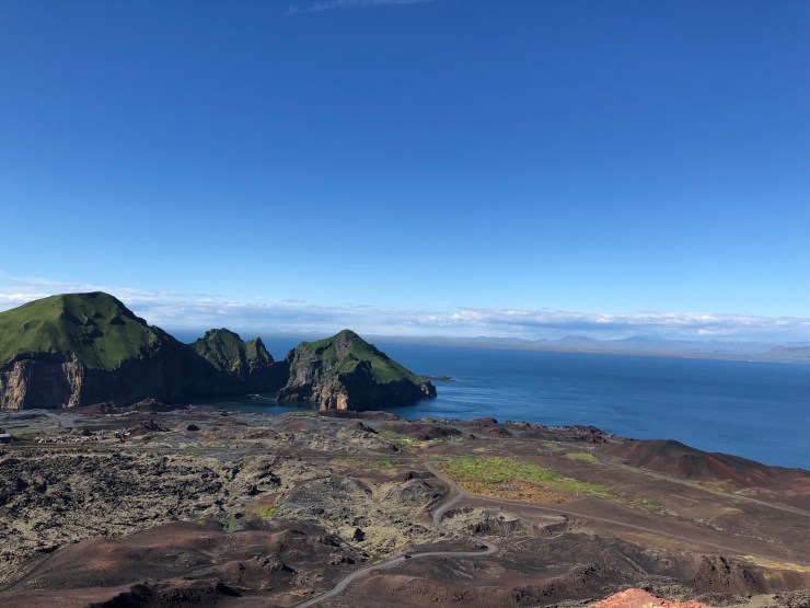
The top of the crater is a narrow, dusty, dirt ridge that tapers to a point. The view and the wind are both incredible up there.
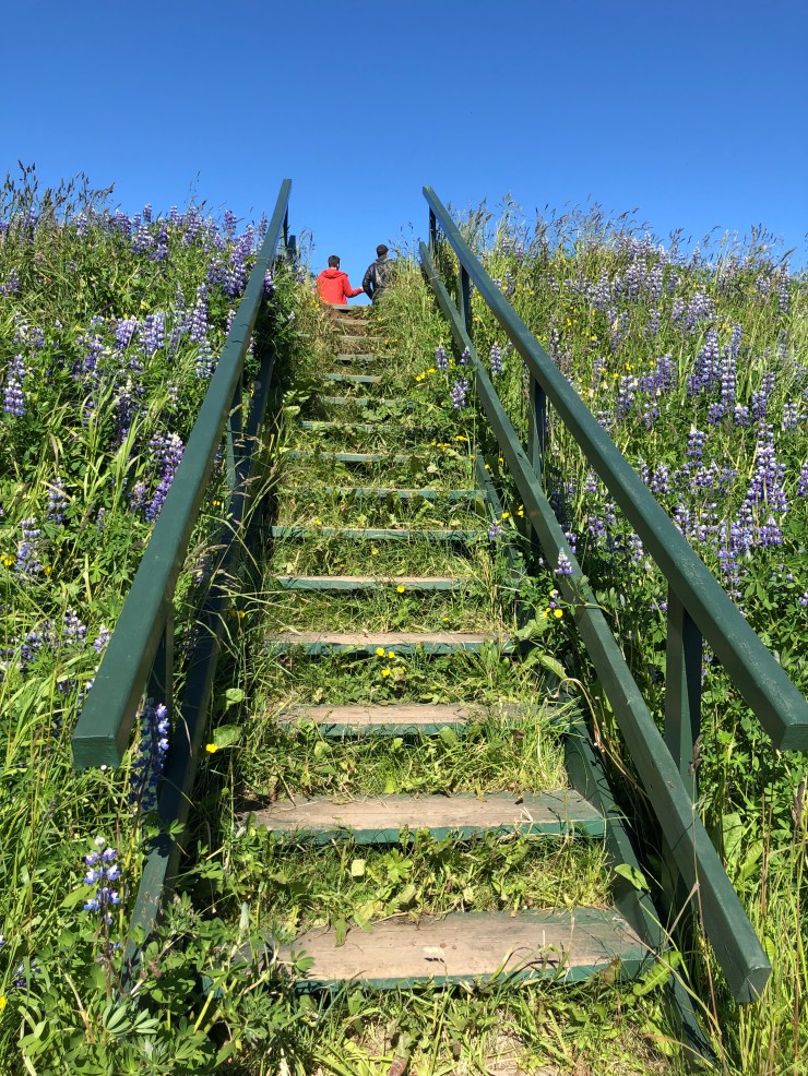
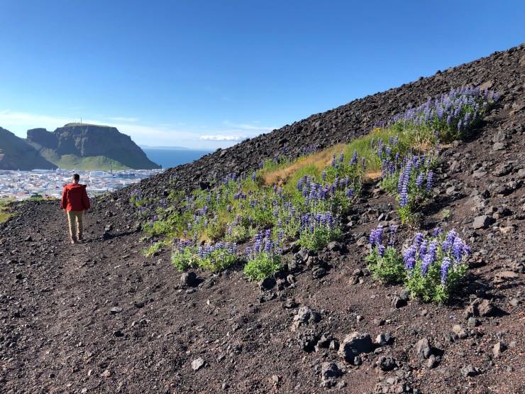
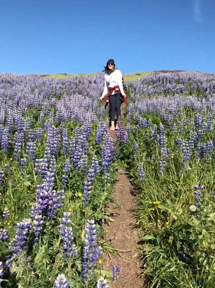
The best part of the downclimb was walking a narrow path through a huge field of Alaskan Lupine (purple flowers).
 Back on the road, we made our way to the bike rental stand, hoping to cycle up to a marked puffin watch spot. Unfortunately, there was not a bicycle (or attendant) in sight.
With the knowledge that everything was only 20 minutes away, we decided to take another hike up the puffins trail on the west side of the island.
We followed the pocket map we had to find the trailhead and started what promised to be an incredibly steep climb.
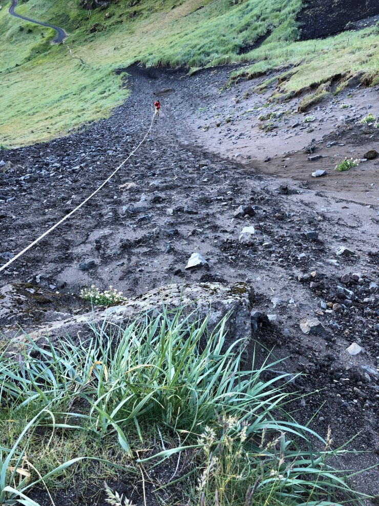
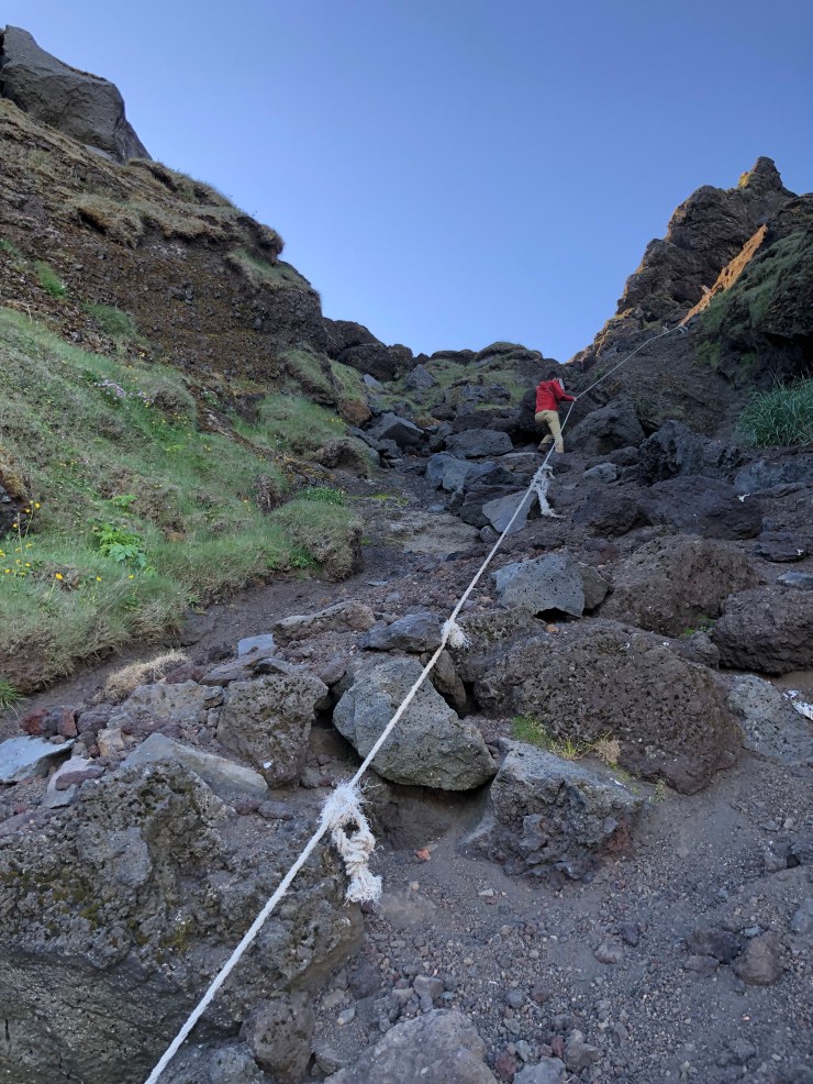
About halfway up this “trail”, we agreed that it was a dumb thing to attempt and was too dangerous. Most of the footing was deep, crumbling lava dirt/sand/ash. The rest were huge rocks that were barely hanging on to the mountainside. It was a landslide begging to happen, made no better by our trekking through it.
The only way to the top was by a handrope that has seen better days. Though we could recognize the risk, we also could see the top and decided to keep going.
For 3/4 of this hike, we still thought we were headed to see puffins. In the last quarter, when it got really tricky, we knew we had messed up.
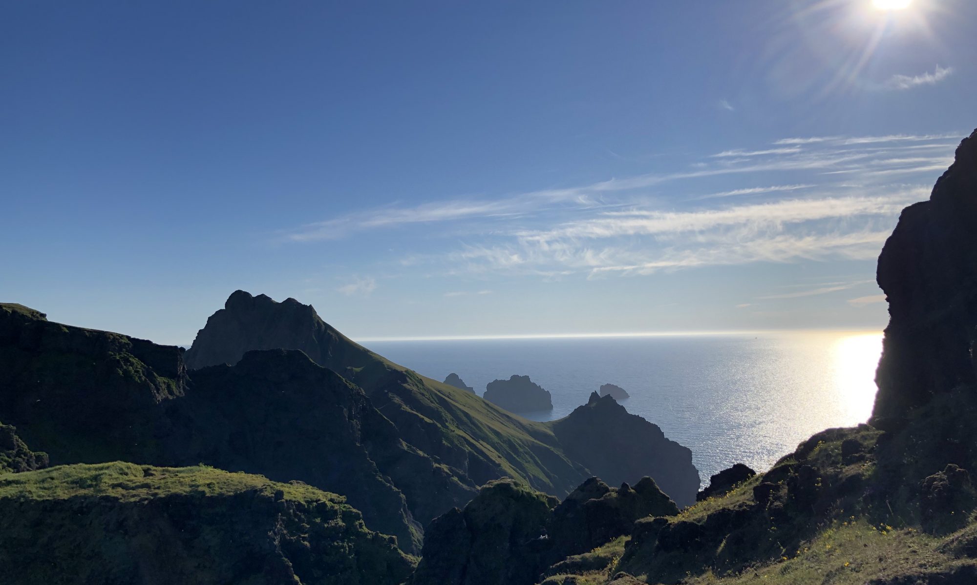
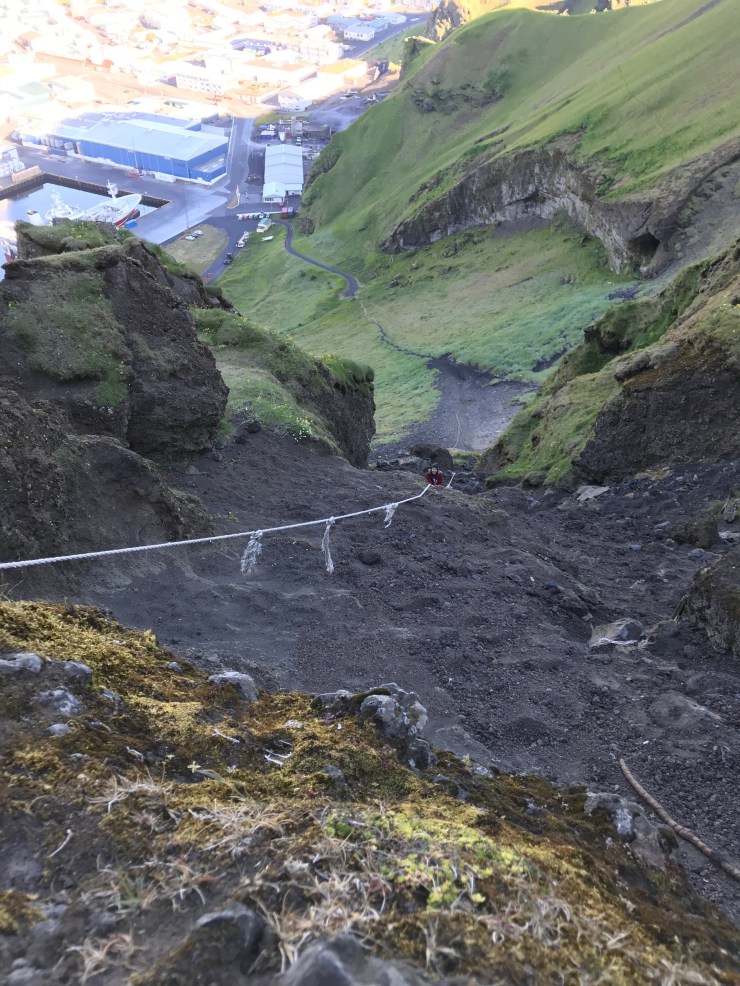
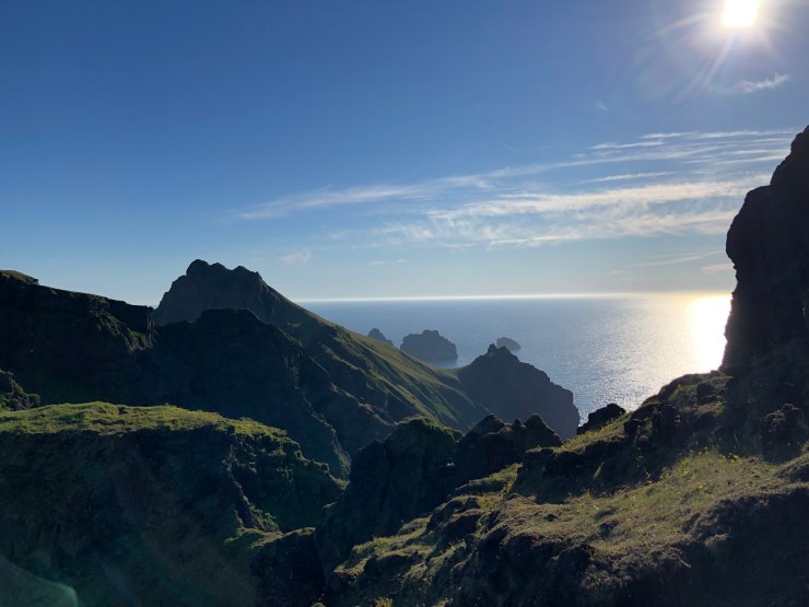
Where we were actually headed was some kind of communication tower. At least the view was good:
The way down was frightening at the top, and toward the bottom, mostly just dirty but otherwise fine. I’ve certainly never been covered in that much dust before.

Right at the bottom of the trail we met with some sheep, who were much less interested in us than we were in them.
How did we end the adventure? With pizza, of course 😜
Love,
PD

One Reply to “”